

Ice, specifically water ice, is a very useful resource for planetary colonists and explorers alike as it can be used to grow crops and even form the basis of rocket fuel.
The martian north- and south pole are both covered with a layer of frozen carbon dioxide, also known as dry ice, of respectively 1 meters and 8 meters thick. However, fortuitously, apart from the top layers, both martian poles predominantly consist of water ice! But how long has it been there? In this article, Matt Williams explains what we know so far.
By Matt Williams
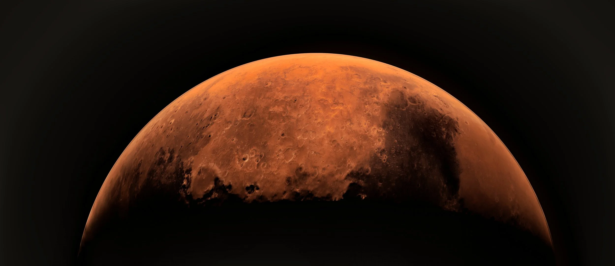
A gorgeous view of the Martian north pole as seen from orbit - Credit: ESA/DLR/FU Berlin/J. Cowart - HDR tune by Universal-Sci (CC BY-SA 3.0)
On Earth, the study of ice core samples is one of many methods scientists use to reconstruct the history of our past climate change. The same is true of Mars’ northern polar ice cap, which is made up of many layers of frozen water that have accumulated over eons. The study of these layers could provide scientists with a better understanding of how the Martian climate changed over time.
This remains a challenge since the only way we are able to study the Martian polar ice caps right now is from orbit. Luckily, a team of researchers from UC Boulder was able to use data obtained by the High-Resolution Imaging Science Experiment (HiRISE) aboard the Mars Reconnaissance Orbiter (MRO) to chart how the northern polar ice caps’ evolved over the past few million years.
The research was conducted by Andrew Wilcoski and Paul Hayne, a Ph.D. student and assistant professor from the Laboratory for Atmospheric and Space Physics (LASP) at the University of Colorado Boulder. The study that describes their findings recently appeared in the Journal for Geological Research (JGR), a publication maintained by the American Geophysical Union (AGU).

The Mars Reconnaissance Orbiter HiRISE as it is being prepared - Image Credit: NASA via Wikimedia Commons
For the sake of their study, Wilcosky and Hayne sought to determine the current state of the Martian North Polar Residual Cap (NPRC), which is vital to understanding the North Polar Layered Deposits (NPLD). Using the high-resolution images gathered by the HiRISE instrument, Wilcosky and Hayne examined the rough features of the NPRC – which includes ripples and ridges of varying size and shape.
They then modeled the growth and recession of NPRC over time based on its interaction with solar radiation and how the rate of growth and loss is affected by the amount of atmospheric water vapor. What they found was that in addition to causing the formation of rough terrain (ripples and ridges) in an ice sheet, exposure to solar radiation will also cause ice to sublimate unevenly.
Basically, Mars’ axial tilt, which is responsible for it experiencing seasonal changes similar to Earth, also causes one side of these features to sublimate (the Sun-facing side) while the other does not. This has the effect of exaggerating these features, leading to pronounced ridges and valleys that become more pronounced as time goes on.

If you enjoy our selection of content, consider subscribing to our newsletter (Universal-Sci Weekly)
Overall, the model employed by Wilcoski and Hayne determined that the rough features observed by the MRO should measure 10 m (33 ft) in diameter and 1 m (3.3 ft) deep. Furthermore, their results demonstrated that as the features age, the spatial wavelength (the distance) between each ripple increases – from 10 to 50 m (164 ft). As they state in their study:
“Our results show that the size of mounds and depressions on the ice cap surface suggest that it took 1–10 thousand years to form these roughness features. Our results also suggest that the formation of features on the surface may depend on when water vapor is present in the atmosphere over the course of a year (e.g., summer or winter).”

A composite image showing alternating layers of ice and sand around the northern polar region, taken by the MRO’s HiRISE camera. - Image Credit: NASA/JPL/University of Arizona
These results are consistent with the images taken by the HiRISE instrument of the Martian North Polar Residual Cap (NPRC). What they indicated is that the rough features observed around Mars’ northern polar ice formed within the last 1000 to 10,000 years, which provides scientists with a starting point for reconstructing the climate history of Mars.
Such is the nature of the Red Planet. Today, scientists have a pretty good understanding of the nature of the Martian landscape and how it changes throughout the year. They also have an idea of what it used to look like billions of years ago, thanks to impeccably-preserved surface features that indicate the past presence of flowing and standing water (rivers, streams, and lakes).
But the intervening period, where the climate transitioned from one to the other, that’s where much remains to be learned. In the coming years, robotic missions could be sent to Mars for the sake of studying the ice sheets directly and maybe even return samples to Earth. In the next decade, as astronauts begin to set foot on Mars, the opportunity to explore the ice caps could also be possible.
Sources and further reading:
Article provided by Universe Today / Edited by Universal-Sci (CC BY 4.0)
More interesting articles on the subject of Mars:
If you enjoy our selection of content consider subscribing to our newsletter (Universal-Sci Weekly)
FEATURED ARTICLES:


